Technology helps firefighters pinpoint hot spots
National Oceanic and Atmospheric Administration
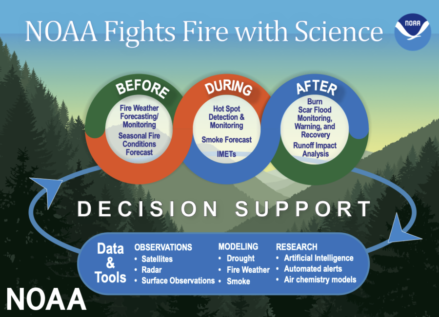
This diagram shows NOAA fights fires before, during and after using technology.
November 15, 2022
With climate change in full swing, states such as California are experiencing some of the worst wildfires in their history. Summers have been getting hotter, drier, and even longer, causing dangerously low levels of moisture in the air. California’s second largest wildfire ever, the Dixie Fire, has burned through more than 960,000 acres of forest and brush in less than a year.
Currently, firefighters use incident commanders, people who have the job of opening up lines of communication, to receive their information on the status of a wildfire; however, this information can take hours to get into the hands of the firefighters, sometimes rendering it useless.
Furthermore, the recent advancements in Artificial Intelligence (A.I.) technology have developed high-tech maps available on tablets and computers. These maps accurately predict when and where a fire will move to allow for firefighters to act ahead of time and possibly save lives.
In addition, the use of drones in the region of Corsica, France has been able to provide valuable information. Using drones, people are able to capture detailed images of the wildfire from a unique perspective. This allows for firefighters to locate the fronts of the fire and provide valuable insight.
This is all made possible by stereovision, a technology within these drones that takes two photos simultaneously. One being of the actual landscape, and another of the 3D renderings of the flames’ physical properties like shape, length, and speed. Both tools, the maps and the drones, are going to grow in use and influence in the future battle against wildfires and climate change.
The ability to render high-definition images from views that are limited to such a small amount of aerial vehicles is something that cannot be taken for granted and not used to its full capacity.